Potlatch River: Little Boulder Campground to Cedar Creek
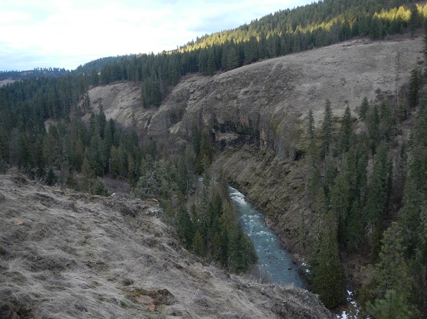
Potlatch River Canyon - Photo Todd Hoffman
Run Description:
There is a large rapid in the upper section known as Coleman Falls. It is the second big rapid below the put in, and is marked by a large tributary on river right.
As of 2013, the traditional "easy" line through the bottom of Coleman Falls on river right is blocked by a log. This increases the difficulty of the run considerably
as the more diffult left line must be run.
From Coleman Falls to the midway access points, there are several more class IV rapids. The first midway point is marked by
the ruins of an old bridge. It is possible to make a 2 mile hike out here on river right. The next midway access points are approximately 3 more miles down stream.
Between the bridge ruins and the second midway access point, the gradient backs off, but the canyon is still vertically walled, and there are some challenging spots.
Don't attempt to drive into the lower midway access point if the road is muddy.
Below the lower midway access point there are three class III rapids. The first is just above the access point trail against at large vertical wall on river left.
The next two are an additional 4 miles downstream. The first of which is a long class III wave train, just after a sharp turn to the right in the canyon.
It is formed by a series of small ledges in a walled in section. The next rapid is a short distance downstream, and is the most difficult
of the three. Its another few miles to the take out.
Potlatch River: Little Boulder to Frog Pond @ 1,000 CFS.
Logistics:
The put in is located at Little Boulder Forest Service Campground. From the town of Deary (located at the junction of Hiways 3 and 8) head
East 4 miles on Hiway 8 to the town of Helmer. At Helmer, turn South onto Forest Service road 1963 (NF-1963 / Park Road). Continue 2.3 miles
to the river. There is a parking lot on the left just before the bridge.
To get the lower take out at Cedar Creek, Head North / East from the town of Kendrick a short distance on
Hiway 3 to the junction of Hiway 3 and Cedar Ridge Road (also designated as County Road P1 and Southwick Road). At this junction, Hiway 3 veers
left (North) and climbs a steep grade, while Cedar Ridge Road stays right and follows the river. Be sure to stay on Cedar Ridge Road (on river
right). Continue up Cedar Ridge Road 6.6 miles to the mouth of Cedar Creek, an unmarked tribuary that drains into the Potlatch on river left
from a narrow side canyon. Note there is limited parking at Cedar Creek.
To avoid paddling the lower section of the river, which can be painfully bony at low flows, there are a few options. One involves a two mile
hike and carry up a gradual grade on an old road. The others both require a 0.2 mile hike, but their trails are much steeper, and
they require paddling 2 to 3 additional miles of flatwater to reach. All of these access points eleminate a significant amount of flatwater (Note that while
most of the section below these points is flat, there are still a few stand out rapids. See the inset map
under "Key Places" for details on how to reach these intermediate access points. They are both reached from East Road just South of Deary on Hiway 3.
To use the upper most access (the one with a two mile hike), it is possible to use a 2 wheel drive vehicle. However, for the two lower intermediate
access points, four wheel drive and an experienced of road driver is recommended. Both trails are unmarked, informal ATV
trails. If conditions are wet and muddy, its best not to use either of the lower two midway access points. The road can get extremely slick, and
there is no other way out of the canyon.
Flow Information:
The Potlatch is an early season run, cranking up in late February or early March, usually finishing by the end of April. Spikes are possible outside the normal season with heavy rains. From the stick gauge at the put in, minimum level is around 3.0'. At flows below 4' the bottom ten miles to Cedar Creek becomes scrapy and cumbersome, so much so that many boaters prefer the difficult hike out of the canyon at a midway point. At flows above 4.5' the upper part of the run increases in difficulty to class IV+/V. There is an online USGS gauge near Spalding, Idaho, but its more than 30 miles downstream and does not correletate well to the stick gauge at the put in. As a rough estimate, look for around 1,000 cfs on the Spalding Gauge for the Potlatch to be runnable.
Stream Stats:
| Ave Gradient: | NA fpm |
| Max Gradient: | NA fpm |
| Distance: | 15+ |
| Difficulty: | IV+ |
| Consequences: | IV+ |
| Min Level: | 3.0' |
| Max Level: | 4.5' |
| Season: | Feb - Apr |